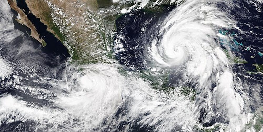
From Sept. 24 through Sept. 29, Hurricane Helene ravaged the Southeast, causing over 200 casualties and a staggering $250 billion in damages. Millions of Americans were left without power, and the devastation in states like Florida and Georgia was clear — thousands of buildings were flooded or destroyed, and the land the storm ripped through looked like a wasteland.
Why does it seem like these deadly hurricanes, fires and tornadoes are always on the news nowadays? Are these natural disasters actually happening more often?
To provide insight on this situation, Benjamin Zaitchik, Morton K. Blaustein chair of the Johns Hopkins Earth & Planetary Sciences department, shared his thoughts.
“It’s really been more about severity than number,” Zaitchik wrote in an email to The News-Letter.
According to Zaitchik, higher total rainfall due to global climate change means that the most severe hurricanes recently have generally been “wetter” than before, causing more flooding.
“We get more rainfall because the warmer climate means there’s more water vapor in the atmosphere. That water vapor is also fuel for the storm since condensing water vapor releases heat, causing air to rise more rapidly and producing even more intense precipitation,” he wrote. “We’re also seeing a potential for more storms with very strong winds (i.e., [Category] 4 and [Category] 5 hurricanes), and warmer ocean temperatures allow for a longer hurricane season.”
The unusually hot summer this year brought abnormally high surface water temperatures to the Gulf of Mexico and the Caribbean Sea. In fact, surface temperatures in the Gulf last month were more than 2 degrees Celsius higher than the ten-year September average, which provided the massive amount of fuel that Helene picked up before landfall.
A phenomenon called “rapid intensification” has made the development of these storms much harder to predict. The National Hurricane Center (NHC) defines rapid intensification as when a storm’s maximum sustained winds increase by 56 kph (35 miles per hour) or more in less than 24 hours. In Helene’s case, wind speeds increased from around 65 kilometers per hour to 185 kilometers per hour in around 60 hours, the fastest-formed hurricane since the NHC started recording data.
“Helene, in particular, hit [a] tongue of very warm sea surface temperatures on its path across the Gulf of Mexico that fueled a rapid intensification,” Zaitchik explained.
Experts have been blindsided by this sudden uptick in rapid hurricane formation even after the development of advanced modern storm prediction tools. Zaitchik also explained how some of these tools help meteorologists track hurricanes and tropical storm development.
“We have a lot of tools for that, including satellite data, advanced weather models, aircraft flights and in situ measurement networks,” he wrote. “The changes that come with global warming are testing the assumptions of some of our predictive models.”
Perhaps the most extreme data collection method involves aircraft known as “hurricane hunters.”
“[These planes] fly into the hurricanes and make measurements from the plane and from instruments it drops,” Darryn Waugh, professor in the Department of Earth and Planetary Sciences at Hopkins, explained in an email to The News-Letter.
Among other metrics, the instruments used by hurricane hunters can measure the live pressure, wind speed and humidity of tropical cyclones, providing valuable information to meteorologists tracking developing storms. A set of aircraft piloted by the U.S. Air Force made nine total trips into Helene’s center during the four days before its landfall, which gave forecasters a much better idea of Helene’s intensity and velocity.
Another recent storm, Hurricane John, made landfall in Mexico two days earlier than models had predicted. This left experts limited time to warn both residents and government officials of the imminent storm, and many residents weren’t able to evacuate their homes before John made landfall. Almost 100,000 residents lost power, 22 deaths were confirmed and the overall financial impact is still being tallied, with water tower damages alone totaling over 62 million dollars.
Furthermore, many residents in the region were still recovering from 2023’s Hurricane Otis, the strongest Eastern Pacific hurricane to make landfall since satellites began to track hurricane activity. Otis, a Category 5 hurricane, resulted in hundreds of casualties and billions of dollars in damage. Experts predict that the frequency and severity of hurricanes will only continue to increase throughout the 21st century. In the late 20th century, the odds of a particular hurricane’s maximum wind speed increasing by 70 mph or more on the day before landfall (a very rapid intensification) was about once every 100 years. But according to models of hurricanes in 2100, the odds of a hurricane undergoing this rapid intensification will increase to once every 5 to 10 years.
So, what can the world do to better prepare for these increasingly common natural disasters? Waugh proposed two ways to mitigate hurricane damage. He explained that he believes actions generally fall into two categories — actions that mitigate the effect of hurricanes through structural changes, like building levees and flood barriers, or through actions that reduce the impact of the hurricane through early warning systems or increased public awareness.
Though governments at large should develop engineering solutions to reduce the effects of severe weather, the root cause of these extreme storms – increased ocean temperatures and atmospheric water vapor – still needs to be addressed through government policy targeted at mitigating greenhouse gas emissions or improving infrastructure to adapt to a changing climate.
“The best way to minimize these impacts is to reduce our greenhouse gas emissions through an urgent push for innovative policies, technologies, and behavioral change,” Zaitchik argued. “But even with the most aggressive greenhouse gas reduction pathways... we’re going to have to adjust to climate extremes, sea level rise and other major changes. That requires integrating adaptation into all of our planning processes. It’s a huge, diverse, messy effort, but it’s necessary.”


